
Real Estate Graphics
De-risk, Design, and Develop your real estate strategy.
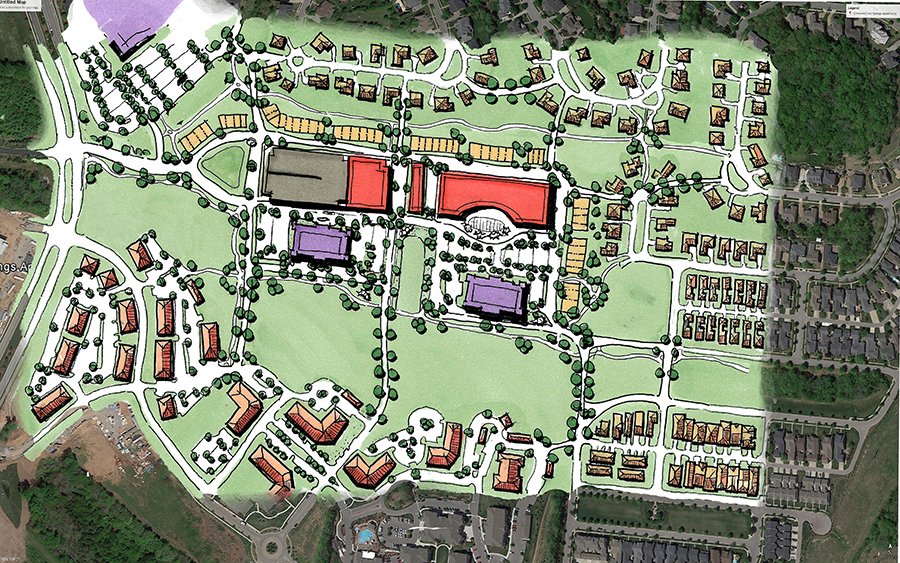
Site Plans
Digital or by hand, a site plan is powerful. Custom images present your vision to your future investors, tenants, neighbors, and city staff. Your investment in graphics will pay many times over as they are reusable for marketing and outreach.
RENDERINGS
Real Estate Projects come together with data in boring black & white. Using layers of CAD drawings, plans, and sketches, the plans can be unclear and overwhelming.
Your project becomes real and understandable with colorful pictures.
MAPS & DIAGRAMS
Through the combination of GIS, online map tools, and aerial imagery sources, your project’s story becomes about the highlighted elements rather than obscured by the noise of too much information. By removing the distractions, you can guide your conversations and promote meaningful discussions.

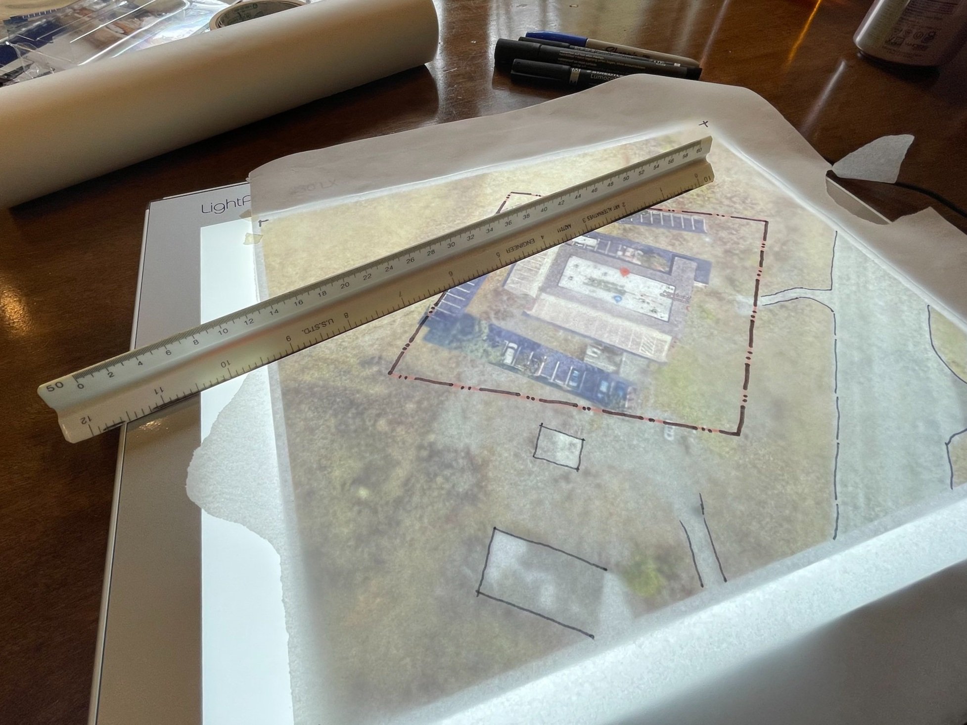
behind the scenes
With over 15 years of graphic experience which includes working in design studios, location-based start ups, and development companies, Surface Area uses multiple data sources and software platforms to cultivate the right image for your project.
We’re happy to create from scratch. We can also take your data and add our magic to craft your project’s narrative.


tools:
Adobe Creative Suite (Photoshop, Illustrator, InDesign, Acrobat)
Microsoft Office (Excel, Powerpoint, Word)
SketchUp - 3D modeling
GIS Tools
Google Earth and Aerial Photography (think - drones)
Analog: Pen, Ink, Trace Paper, Light Table, Scale, and Prismacolor Pencils